Te Ao hurihuri A changing world
Links to resources to help ākonga understand climate change impacts and start thinking about how they might adapt.
During an emergency, Wellington Region Emergency Management Office (WREMO) coordinates Civil Defence and Emergency Management Services on behalf of the nine councils in the Wellington Region.
Follow them on social media or listen to RNZ for the most reliable information.
Resources for your class
Natural hazards provide an interesting and relatable topic for learning. Learning about these at school can help encourage tamariki to prepare for emergencies with their whānau. And it can help them understand the causes of significant weather events or natural disasters.
Many schools also play an important role in events as Community Emergency Hubsopen_in_new. Education Gazette has published a story about how schools in Auckland became emergency hubsopen_in_new during the flooding in January 2023.
Get Ready provides resources to support your school or kura, teachers and students to be prepared.
Get Ready Weekopen_in_new in mid October is a great time to cover these topics with your ākonga and the school community. Your kura can take part in the national Shake Outopen_in_new drill and use the learning resources below to get ready!
Resources for Primary schoolsopen_in_new and Kura kaupapaopen_in_new
- What's the plan, Stan?open_in_new – a free resource to develop knowledge and skills, lesson ideas for Y1-3 and Y4-8.
- Historical emergenciesopen_in_new – see what's happened in your rohe in the past.
Get Ready also recommend the following learning resources:
- Te Hīkoi a Rūaumoko | Rūaumoko's Walkopen_in_new is a bi-lingual children’s book based on Kahungunu legends and dialect. It tells the story of what to do in an earthquake and tsunami.
- The tsunami that washed time awayopen_in_new is a Ministry of Education teachers resource focused on researching a historic tsunami in Henderson Bay in Northland.
- The STOP DISASTERSopen_in_new game helps adults and children understand how disaster risk is shaped by human choices.
- What’s On Our Plates?open_in_new is a set of multimedia learning modules designed to enable anyone to explore Aotearoa New Zealand’s active plate boundary online, including the Alpine Fault and Hikurangi subduction zone. There are currently five What’s On Our Plates? learning modules, with more coming soon.
- LEARNZ Tātai Aho Rau has a module from October 2025 on Natural Hazardsopen_in_new
NIWA (now part of Earth Sciences NZ) also have a range of resources, including the My Coastal Futuresopen_in_new game. This is recommended for ages 10 and over, and can be played in any device. It will take about 10 minutes.
They have more education resources on their educationopen_in_new page.
LEARNZ has resources covering many disasters including our most common hazard, floodsopen_in_new.
- Watch this video from 2022 showing what happens in the WREMO Emergency Coordination Centre (ECC) when there is an event.
The Natural Hazards Commission Toka Tū Ake shared the following useful kupu, along with a video on Facebookopen_in_new in September 2025.
- Earthquakes – Ngā rū
- Tsunami – Ngaru taitoko
- Landslips – Ngā horo
- Volcanoes – Ngā hū
- Hydrothermal activity – Ngā ngāwhā
Rachel Bolstad has compiled a Padlet under Curriculum for the Future. This has links to slides, research, planning templates and much much more:
NZCER have written a few articles about how schools respond to their role in emergencies:
- Leadership and school-wide climate responses: Research briefing 2open_in_new (2021, Bolstad)
- Is education part of Aotearoa NZ's climate adaptation plan?open_in_new (2022, Bolstad)
- Fronting up to the challenges for education in a climate-changed Aotearoaopen_in_new (2023, Bolstad)
Ministry for the Environment have information on the National Adaptation Planopen_in_new for all New Zealanders.
GW taking action on climate change
We’re leading climate action in partnership with mana whenua and our communities, to protect our region now and for future generations.
The tools selected below are available on our main website, and may be useful for students who want to know more about our rohe.
Find out what climate change means for you and the region with our interactive toolsopen_in_new. Including:
- Sea level rise modelling
- Impact maps of climate change (image below)

Screenshot of GW Impact maps
See how our organisation is acting on reducing emissionsopen_in_new.

Across our region emissions are going trending down despite an increase in population. Find out more about the current data and trends on our monitoringopen_in_new page.

This planopen_in_new identifies our immediate courses of action and major areas of work needed to achieve our targets and live up to the expectation created by declaring a climate emergency
With a grand vision for long-term restoration, areas once barren and lacking in biodiversity will, over time soon be enveloped in a vibrant green ‘cloak’ of native vegetation. Mother Earth herself, Papatūānuku, will reclaim her rightful beauty, and our park ecosystems will flourish with newfound vitality. Join us on this journey towards a healthier, greener future!
|
Ka ora te wai Ka ora te whenua Ka ora te whenua Ka ora te tangata |
If the water is healthy the land will be nourished If the land is nourished the people will be provided for |
What's next?
Kōrero miramira Inspiring stories
Articles and links that share experiences from school communities and showcase student voices and actions in Aotearoa.
Related Lessons
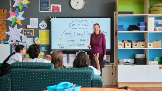
He aha rā te hirahira o te Āhuarangi Hurihuri? What’s the big deal about Climate change?
Three lessons that set the scene for teaching climate change, carbon emissions, the greenhouse effect and more. A series of hands-on lessons to capture the imagination of every student.
Te ine i ō tātou tukuwaro Counting our carbon emissions
The final lesson in the series that measures carbon dioxide emissions in a way that makes sense to a student's everyday travel. Raise awareness of the carbon we create and what changes we can make.
Teacher planning and development
We have linked resources from trusted organisations to help you to develop a programme across a range of curriculum areas. More to come!