Paraia Taku Ara Map my Journey
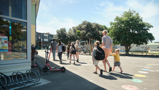
What is the safest route to school?
Akoranga takamua Before You Begin
Consider how you might use this activity alongside Walkability, Walking School Bus, Walking Pou or Park and Stride.
About this resource
Lesson 1Ākonga (students) will map their route to kura (school), identifying safe and unsafe places in their neighbourhood. This resource can either be a stand-alone activity to connect with health, wellbeing and climate action or could be part of a deeper enquiry. You may need to adapt this resource to suit their road environment; this resource mainly focuses on kura in urban areas. This lesson may take 1-4 sessions depending on your class age and ability. |
 (760 KB, Pdf)
 |
Lesson 2Lesson 2 focuses on awareness. Ākonga draw their own map of their route to kura. Note: you may need to adapt this resource to suit their road environment; this resource mainly focuses on kura in urban areas. Ākonga will need adult support to complete the tasks.
|
 (351 KB, Pdf)
 |
Student resourceUse the Map My Journey student resource in class or send home to complete with a parent, caregiver or whānau member. |
 (300 KB, Pdf)
 |
Supporting resources and links
You could implement this as a maths lesson, such as measurement, direction and statistics, or as an inquiry topic at the start of the year, when focussing on communities and sense of belonging. This activity is useful when used in a larger context, for example:
- To encourage ākonga to walk to kura
- Creating a Walking School Bus
- Creating a Park and Stride or Walking Pou
- Using the Active Travel Action resource
- Before or during Movin’March or alongside Movin’March resources
Ākonga who have been driven to kura:
- Draw the route they would use if they could walk or wheel to kura.
- If their street isn’t on the map, ask them to choose a different starting point, for example, a safe drop-off point where they can walk or wheel from.
Kaiako (teachers) - please be aware of any risks and legal responsibilities when using private data/personal information, such as identifying where students live or showing their home address.
This information should not be shared or available to anyone outside the kura staff and student’s family. For example, do not display maps where other people may see them. If in doubt, ākonga could use a fictional address or a local landmark, such as a park, shop or community centre.
Respecting diverse whānau living arrangements will ensure ākonga feel included in discussions. Please also consider ākonga who may live at two addresses.
Maps
Download and print maps from: www.google.com/mymapsopen_in_new
Greater Wellington regional maps (GIS): GW mapping - Homeopen_in_new
Safety
Visit the Waka Kotahi NZTA education portalopen_in_new for a range of road safety curriculum resources.
Watch the Wellington Paranormal Scooter Safety videosopen_in_new for tips on how to keep safe around sneaky driveways and crossings.
Further activities:
Contact your local Police School Community Officeropen_in_new or a local community representative that is appropriate and relatable for your tamariki, for road safety advice.
Contact your local Enviroschools’ facilitatoropen_in_new for support.
Visit Greater Wellington Regional Council’s School Travel websiteopen_in_new for other safety related resources: to explore with ākonga and whānau more ways to develop safe and active ways to get to school.
Sign up for safety skills sessions with Greater Wellington Regional Council’s programmes such as Pedal Readyopen_in_new or Scooter Readyopen_in_new.
What's next?
Rārangi Hīkoi Walkability Checklist
How walkable is your school neighbourhood?
Related Lessons
Te Waka Hīkoi Walking School Bus
Leading a Walking School Bus project at your school.
Te Haerenga o ngā Tamariki The Children's Journey
Everything you need to start using Te Haerenga o ngā Tamariki, an online tool that lets students collect their own trip data. Learning experiences designed for you, plus handy guides.
Māia Confidence
Mā raro, mā wīra rānei nā te mea he pai mō tōku toiora!
I walk or wheel because it builds confidence!